NO "TOUR GROUP" LIMITATIONS
ANYWHERE
YOU WANT TO GO
WE TAKE YOU!
CHEMI
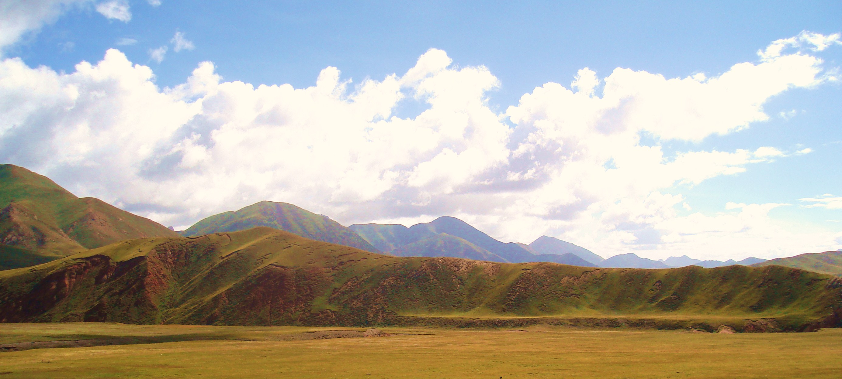
WILDEST MOUNTAINS ON EARTH HIGHEST - STEEPEST
- PRETTIEST
"Eastward the
dawn rose, ridge behind ridge into the morning, and vanished out of
eyesight into guess; it was no more than a glimmer blending with the
hem of the sky, but it spoke to them, out of memory and old tales,
of the high and distant mountains."
- JRR
Tolkien
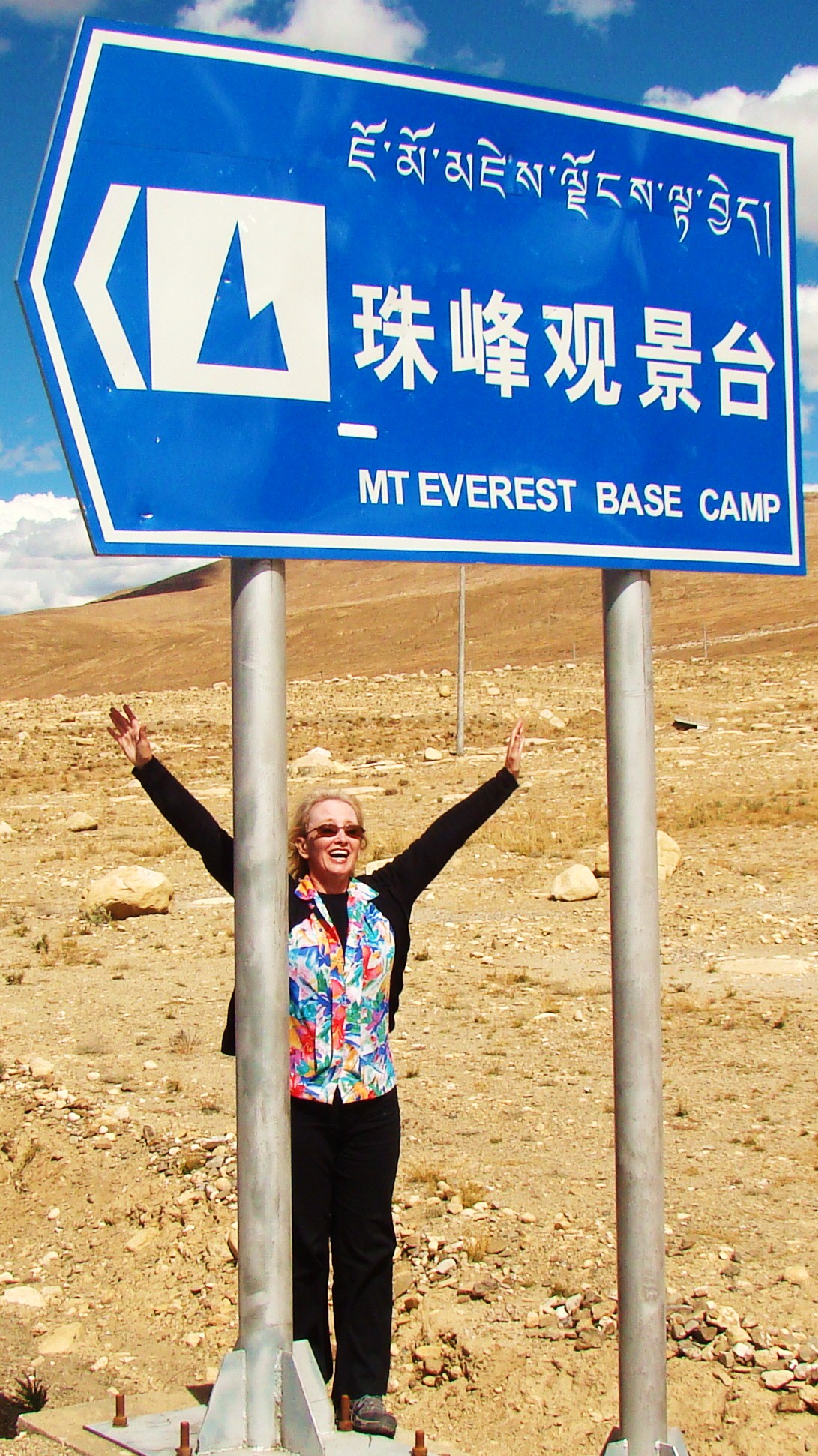
Visiting
Everest Base Camp can be added to almost any tour schedule
and does not require special equipment or experience.
Ask your guide. Our
private guides are not mountains climbers or specialist in
mountaineering. For your convenience we have gathered some
information from professional organizations specializing in
high altitude trekking.
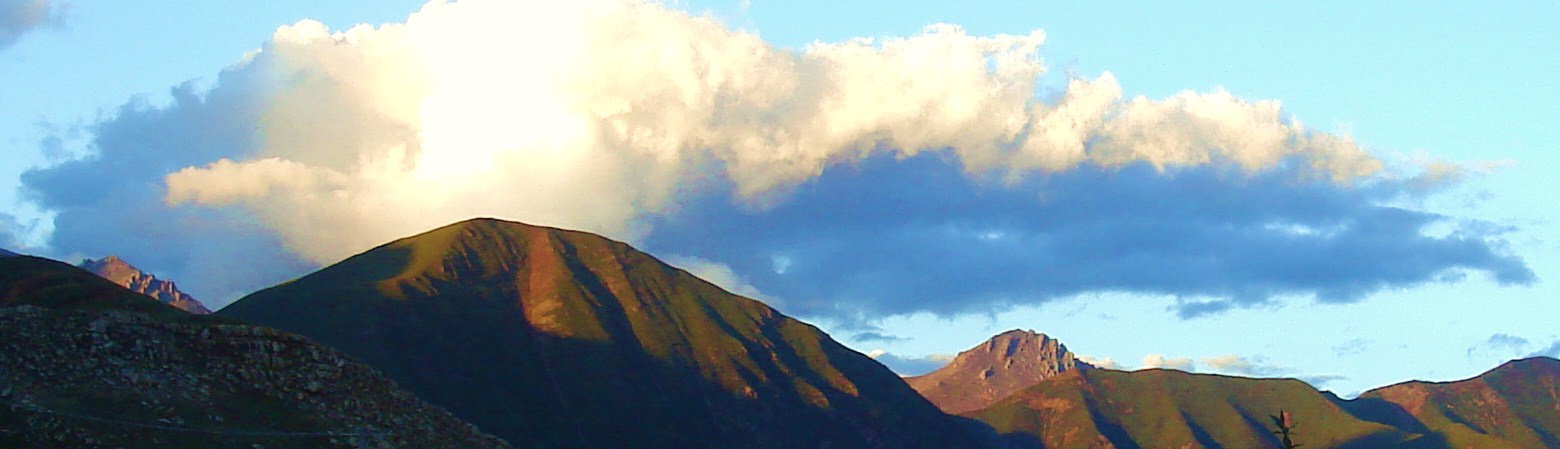
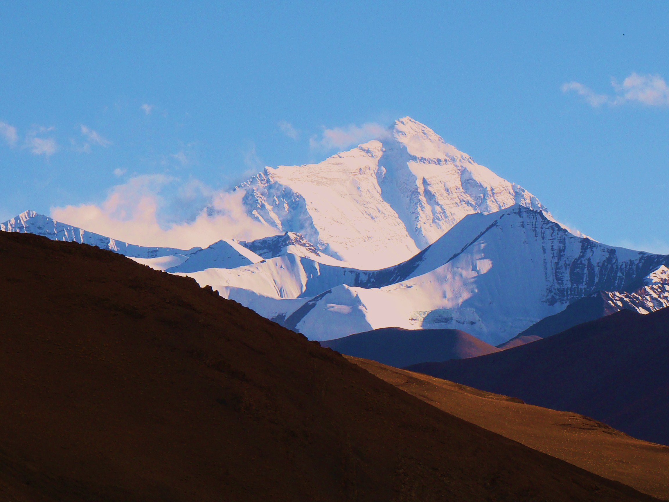
MT EVEREST 29,030 Ft
Base Camp 17,500 Ft This
is the north face of Everest taken from Base Camp. There is
a monastery (farther down) or nomad tents (base camp) to
accommodate travelers who wish to stay the night and see
Everest at dusk and dawn. It is reached by an easily
accessible highway.
ROOF OF THE WORLD
TOP OF THE WORLD
Tibet
is one of the world’s most isolated
regions, surrounded by the magnificent
Himalayas on the south, the
Karakoram Range on the west, and the isolated
Kunlun Mountains on the north. With an average elevation of 4,900
meters (16,000 ft), it is the highest
region on Earth. Most of the inhabitants of Tibet live at elevations
ranging from 1,200 m (3,900 ft) to 5,100 m (16,700 ft). Among the principal
peaks are
Mount Everest (8,850 m/29,035 ft), the world’s highest mountain; Namcha
Barwa (7,756 m/25,446 ft); and Gurla Mandhata (7,728 m/25,354 ft). The Tibetan
Plateau, which slopes progressively from south to east, is interspersed with
mountain outcroppings of an average elevation of about 4,510 m (about 14,800
ft). The eastern part of Tibet is a rugged region with numerous smaller mountain
ranges interspersed by deep valleys. With mountains and
valleys sprinkled continuously over this land, the stunning views never end!
SUMMIT POST
"Chomolungma
or Qomolangma" to Tibetans, meaning "Mother Goddess
of the Earth". "Sagarmatha" meaning "Goddess of the
Sky" to the Sherpa people, (invented in the 1960s by
Baburam Acharya in response the the rising question that the
Mountain had no Nepalese name). Mount Everest
gets its European name from British Superintendent General
of the Survey of India 1830-1843, Sir George Everest. The
ancient name for the mountain is Devgiri, meaning
"holy mountain" or Devadurga may have been pronounced
it as deodungha by the English in the 1800s. courtesy of
SummitPost.org
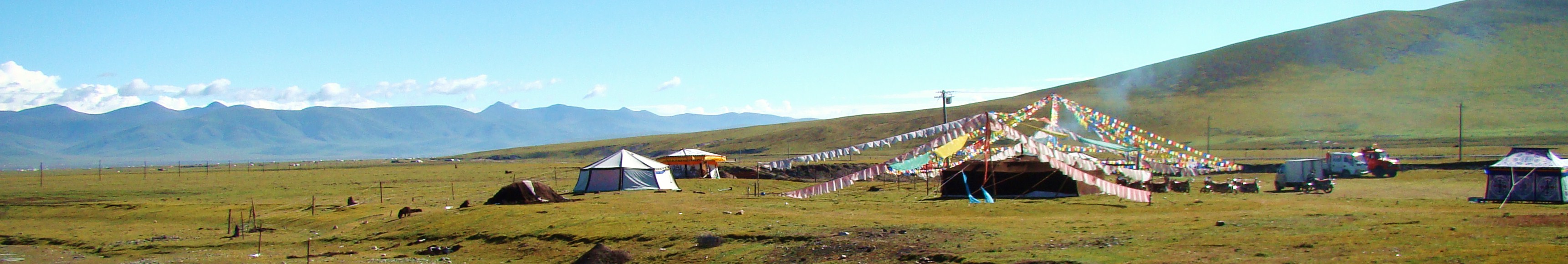
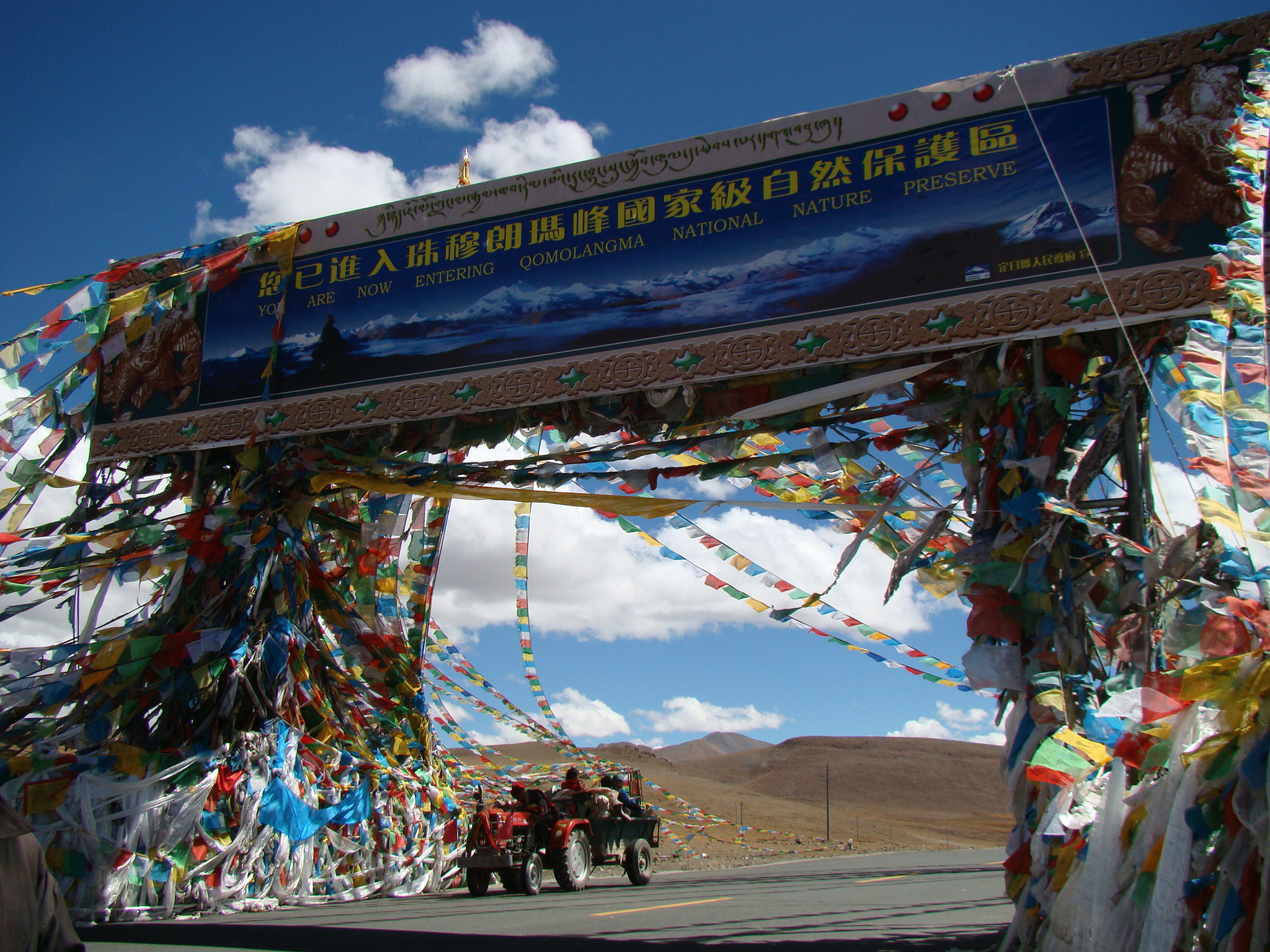
XEGAR
Xegar is a quaint little town at the base of Mt.
Everest, which is currently administrated as part of Chinese
land mass. It is only notable because it is the starting
point for many climbing expeditions to the highest mountain
peak in the world. Other names for Xegar include Shekar
Dzong and Tingri. The town is at an elevation of 14,891 feet
above sea level and there are a little better than 500
people living within 7 km of the center of the town.
Services here are basic, but sometimes a bowl of rice fits
the bill! Good fried potatoes also work.
SEVEN
SUMMITS EXPEDITIONS - MOUNTAIN MADNESS.COM
Dreaming of
the mountains is a time honored fascination for humans.
Until recently, climbing in the rarefied air of the highest,
remotest peaks on the planet was the exclusive domain of a
few highly skilled and intrepid adventurers. Now, for
determined individuals following the philosophy behind our
"Live Your Dreams" program, the Seven Summits are no longer
the exclusive realm of only elite mountaineers.
more
In this area, in addition to the world famous Mt.
Everest, the other three holy mountains of Tibet include Chowori in
Gonggarchasam, Hapori in Samye and Gongpori in Tsedang.
WESTERN TIBET HOLY MOUNTAINS
MT. KAILASH
Awe inspiring "Sacred" Mt. Kailash and "Holy
Lake" Lake Manasarovar are venerated places for many faiths,
including Tibetan Buddhists, Buddhists, Bon, Jains, and to
those with other esoteric beliefs. They come to walk the
kora around the mountain, around the "center of the world".
Not only is this trek a life-long goal for pilgrims, but
many visitors find the attraction irresistible.
Ancient Sanskrit documents tell us the Gangdise Range had become a holy mountain 2,000
years before Christ. A Hindu myth explains how a palace for the
god of gods was build on Mt. Kailash. With 6656 meters, this is
an extremely important mountain in Asian and Tibetan history.
Tibetan Buddhists have a belief that the mountain is in a shape
of an olive. The legendary palace is thought to have been build
right on the peak. Centuries ago a visiting Bangladesh monk
heard bells chiming from the palace, along with drums beating
and mysterious sounds. Even pilgrims today claim to hear things
during their kora around this mount.
Kailash crowns the Himalayan Mountains with its
innumerable myths
and legends. By far, it remains the focus of the religions that
believe in the magnetic draw of the mountain. It takes from
24-36 hours to make the full circle (kora) around the mountain.
Some people caravan with their yaks, camp and do the kora in two
days time. This
form of worshipping is common to Tibetan Buddhists who do koras
around all important religious sites. The more koras done, the
better your life now and the next time will be. This deep rooted
notion of circling holy mountains and places started in ancient
times with pagan rituals.
more
NYINGCHI TIBET HOLY MOUNTAINS
Pungri Holy Mountain, Tibet
Pungri Holy Mountain is located
southeast of Nyingchi County on the northern bank of the
Yarlung Zangbo River. It is one of the
mountains holy to Bon believers.
Bon religion is the ancient religion of Tibet, before Buddhism came on the
scene. Although Bon has taken a back seat to Buddhism over the centuries, it
is interesting to note the Bon traditions that have slipped in making
Tibetan Buddhism unique among Buddhist sects. To circumambulate the Pungri
Holy Mountain takes about three days or so. There are interesting
monasteries all around this mountain, but plan
for seven days if you desire to stop and enjoy the full aroma of this place.
For convenience, there are horses and yaks for hire in Nyingchi and your
private guide can help with all the details. Luckily the monasteries on the
mountain DO provide food and lodging for pilgrims and that includes
wandering tourists!
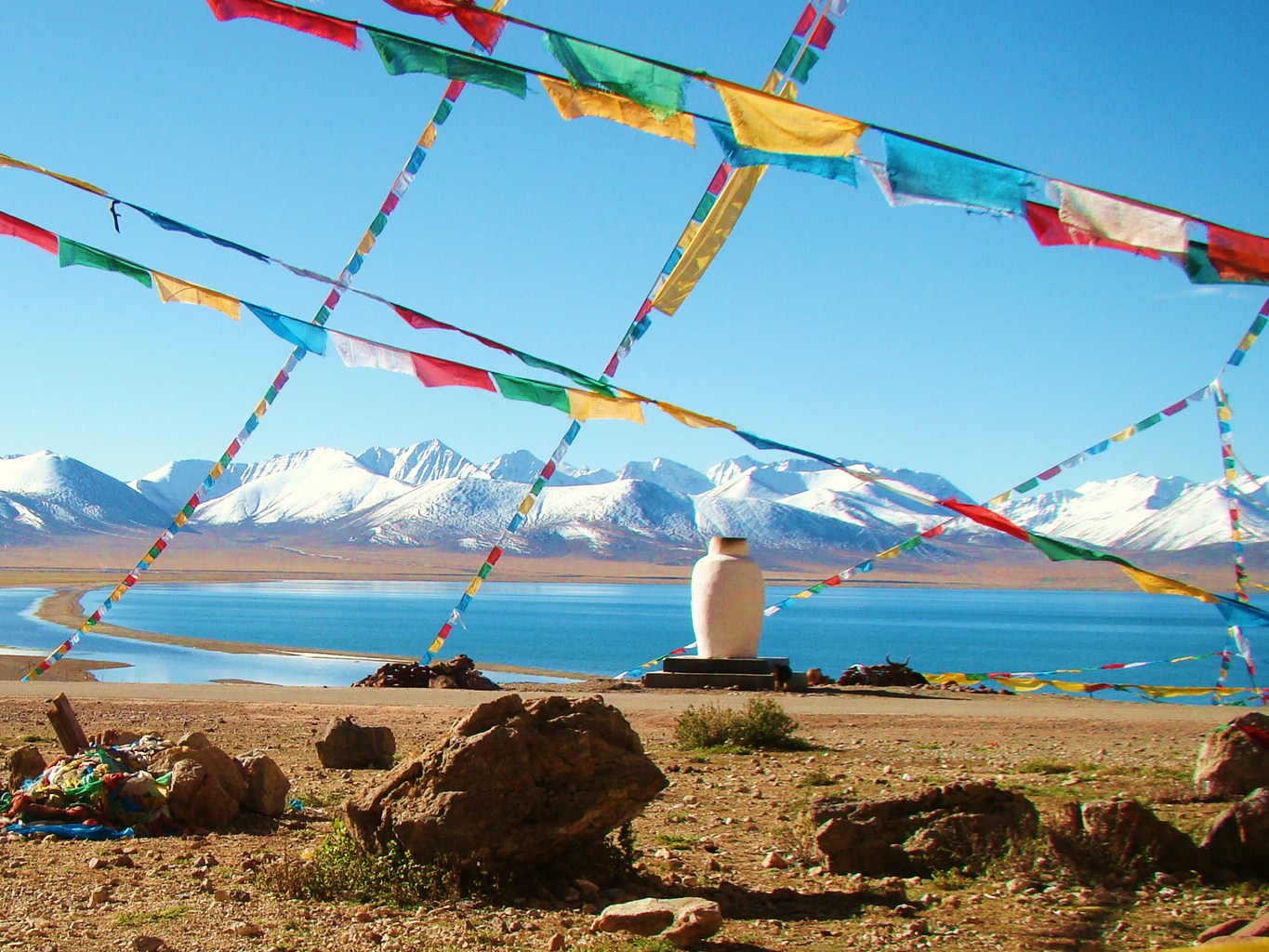
Nyainqentanglha
Mountains, Ngari, Tibet
The 7,117-meter Nyainqentanglha is located on the
south of Lake Namtso and 100 kilometers to the north of Lhasa. It is the highest
peak in Nagqu Prefecture. The Nyainaentanglha Mountains and the Namtso Lake are
described not only as the most attractive holy mountains and lake, but also
lovers and a couple for life and death. Lake Namtso, mirroring the inverted
image of Nyainaentanglha, becomes more beautiful and attractive; Nyainaentanglha,
reflected by lake Namtso, becomes more handsome and upright and draws countless
visitors and pilgrims. Cloaked by cloud and mist all the year and frequented by
angry lighting and tolling of thunder, the snow-capped Nyainqentanglha stands
majestically over the plains, gorges and lower mountains ranges. The ancient
legend and local folklore of shepherds and hunters has it that in the depths of
the Nyainqentanglha mountain range there is a mysterious crystal palace.
The
palace door, inlaid with a myriad of precious stones, is dazzlingly radiant,
almost enough to blind the onlooker. The palace itself, with the top surrounded
by fluffy white Tibetan clouds and the center colored by misty lights floats
over the sea of amrita (nectar like ambrosia). Fresh and vibrantly colored
flowers encase the scene that binds the mind eternally. On Nyainqentanglha peak,
a deity rides on a holy horse, but only some saints can see it. This fair
skinned, three-eyed, handsome and princely diety wears a tri-colored dress of
satin, the smock laminated with rare stones and pearls. For those with eyes to
see, this guardian is smiling at them as he clasps a stunning string of crystal
prayer beads in his left hand while holding a rattan scourge overhead, a
warning, a complex message only some can understand. If your spirit is ready and
your legs nimble, if you have unlimited time to enjoy the land of Tibet, this
could be an interesting and inspiring mountain to tackle.
Kangri (Kangrinboge Peak) - Ngari, Tibet
The Kangri is one of the main
centers of Tibetan Buddhism, Hinduism and the Bon. It is the summit of the
Gangdese Mountains, and enjoys worldwide fame even though it is quite far from
Qomolangma (Mount Everest) and not near as high. Geographical altitude matters
little in the realm of true spirituality. About 6,714 meters above sea level,
the mountain is powerful and imposing, and denotes a sacred station in many
religions. The Tibetans named the peak "Kangri," meanings "treasure of the snowy
mountains." Another name is Kangrinboge Peak. In Buddhism and Hinduism this peak
occupies a position as important as the Mandala, or the center of the universe.
It is also thought to be the "Heaven of Siva" in Hinduism. For hundreds of
years, Kangrinboqe has attracted numerous religious followers and travelers with
its many mystical stories and legends. Many pilgrims spend a year walking here,
doing prostrations all along the way.
GOLOG HOLY MOUNTAINS - QINGHAI,
TIBET
Amnya Machen
Nyenbo Yurtse
Golog Tibet Autonomous Prefecture is located in
southeastern Qinghai province, in the Amdo region of Tibet. Golog is celebrated
across the Tibetan Plateau as being the home of Amnye Machen, one of the
four key holy mountains of Tibet. It rises 6282meters or 20,600 feet and is the
highest mountain in the Amdo region. Each year thousands of pilgrims make their
way to Amnye Machen to make a pilgrimage (kora) around the mountain, many doing
prostrations the length of the circuit. The tramp around the mountain takes
about seven days. You will definitely need guide service and pak animals, tents,
etc. Ask your guide.
Yes, there are numerous holy mountains in Tibet
(traditional boundaries). One of the rarely-frequented sacred mountains in Golog
is Nyenbo Yurtse. Because it is located in a remote eastern corner of Golob
perfecture at 17,000+ feet (5300+ meters, few tourists have been lucky enough to
witness the beauty of this place. In all of the Tibetan Plateau if may be the
most seductive beauty here. There is a deep fresh water lake at the base of the
mountain that is so clear and pristine you can shave the finest hairs of your
chin while looking into it. Many rivers flow into the lake make this a hikers
paradise. Ask your guide about adding Nyenbo Yurtse to your list of Tibetan
adventures!
TIBET MOUNTAIN NEWS
Deforestation
Tibet's total forest cover declined from 25.2 million hectares in 1949 to
13.57 million hectares in 1985 alone, which means 46 percent destruction.
According to Chinese official statistic from 1959 to 1985 Tibetan timber worth
US$54 billion were cut down and sold in the international timber market by
China. No recent data is available but public outcry doesn't seem to have much
impact. When gold is king, nature is a slave. No one can say when deforestation
will stop, but apparently not until the world awakens.
Grassland Degradation
Tibet is 70 percent grassland and the health of these extensive grasslands
are fundamental to the survival of about 1 million people consisting mainly of
nomads and about 70 million domestic animals such as sheep, goat
and yak and countless number of wildlife. Damage from overgrazing can happen to
some degree. Sheep, preferred by Chinese, yank out the grass while the yak licks
and leave the stalk. Military encampments also contribute to the degradation of
grasslands.
SAVE MONEY - NO MIDDLE MAN
- CUSTOM TOURS Hire a Private Tour Guide
Home -
Terms of Use -
Disclaimer -
Press/Media -
Cancellation Policy -
Return Policy -
Privacy Statement -
Report Website Issue -
Unsubscribe -
Contact
DISCLAIMER: The data
on this website is the collaborative experience by both travel professionals and
non-professionals, contributions, and research of various websites,
books, documents, research, articles, associates, attorneys, etc. The
information on this site may or may not be accurate or up to date. The
primary purpose of this site is education and service. We do not advocate any specific
course of action, but offer ideas to think about. What you do with this
information and any course of action you decide to take, if any, is
entirely your responsibility. We wish you happy travels.

 Visiting
Everest Base Camp can be added to almost any tour schedule
and does not require special equipment or experience.
Visiting
Everest Base Camp can be added to almost any tour schedule
and does not require special equipment or experience.
 Not only is this trek a life-long goal for pilgrims, but
many visitors find the attraction irresistible.
Not only is this trek a life-long goal for pilgrims, but
many visitors find the attraction irresistible.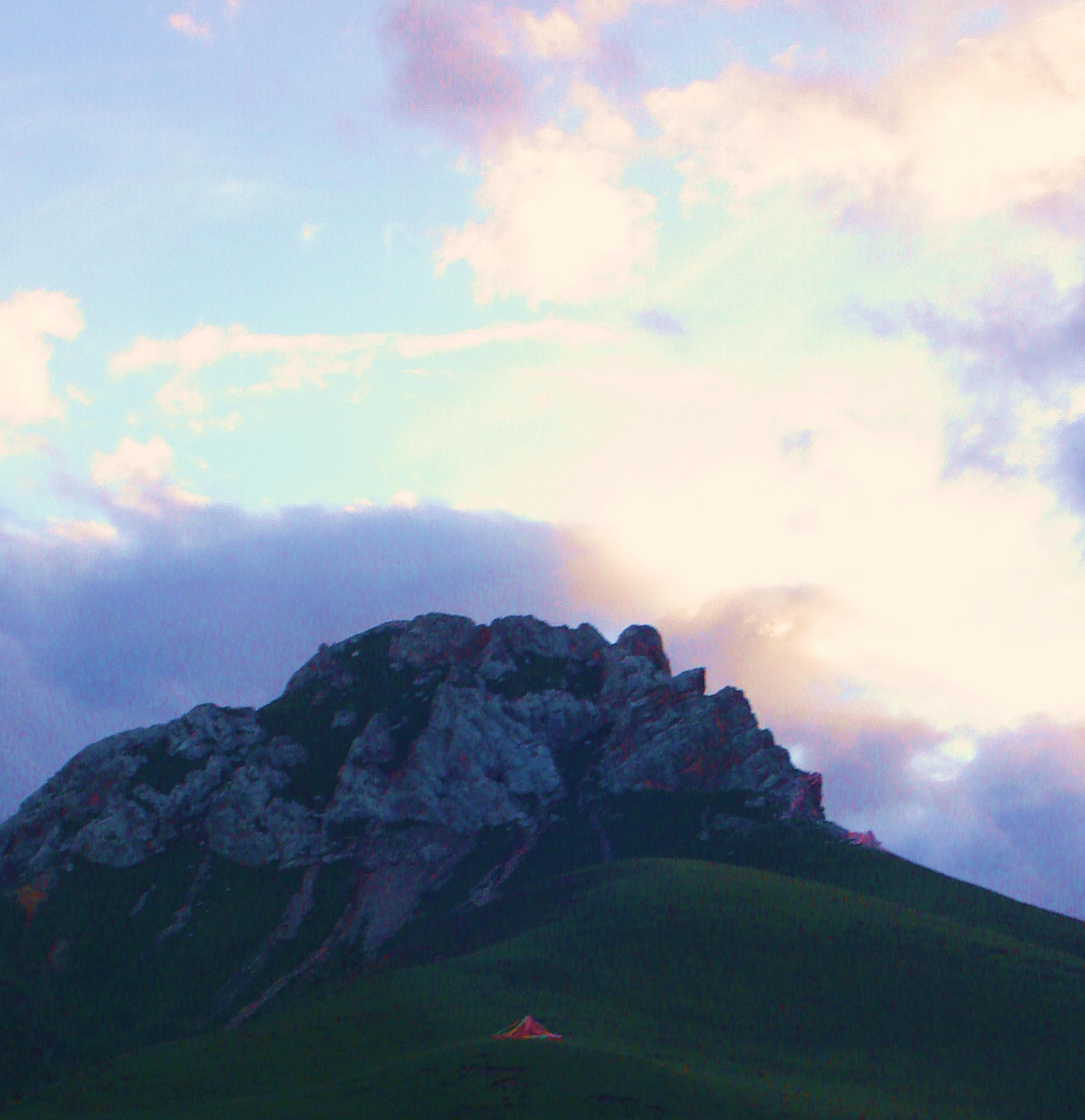 Kailash crowns the Himalayan Mountains with its
innumerable myths
and legends. By far, it remains the focus of the religions that
believe in the magnetic draw of the mountain. It takes from
24-36 hours to make the full circle (kora) around the mountain.
Some people caravan with their yaks, camp and do the kora in two
days time. This
form of worshipping is common to Tibetan Buddhists who do koras
around all important religious sites. The more koras done, the
better your life now and the next time will be. This deep rooted
notion of circling holy mountains and places started in ancient
times with pagan rituals.
Kailash crowns the Himalayan Mountains with its
innumerable myths
and legends. By far, it remains the focus of the religions that
believe in the magnetic draw of the mountain. It takes from
24-36 hours to make the full circle (kora) around the mountain.
Some people caravan with their yaks, camp and do the kora in two
days time. This
form of worshipping is common to Tibetan Buddhists who do koras
around all important religious sites. The more koras done, the
better your life now and the next time will be. This deep rooted
notion of circling holy mountains and places started in ancient
times with pagan rituals. 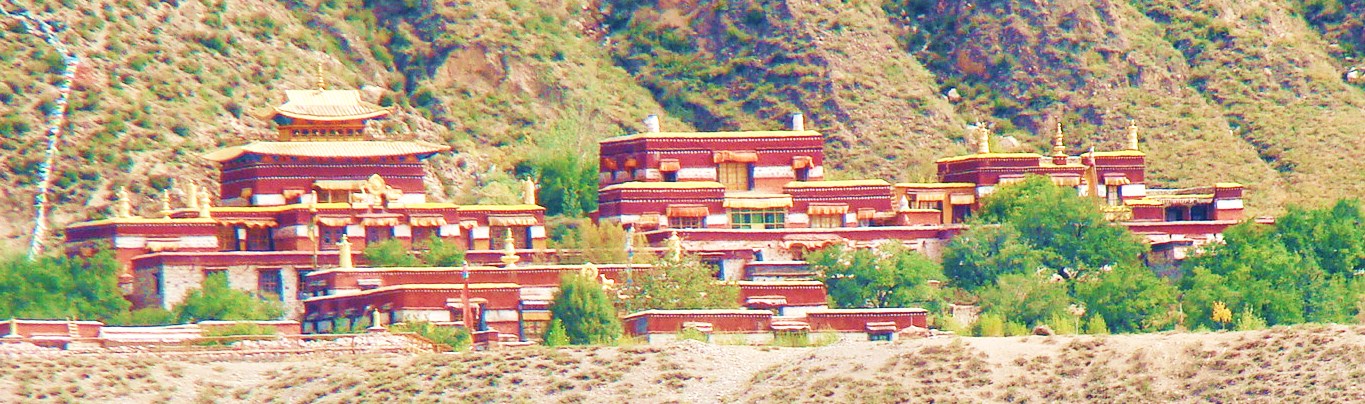
 The
palace door, inlaid with a myriad of precious stones, is dazzlingly radiant,
almost enough to blind the onlooker. The palace itself, with the top surrounded
by fluffy white Tibetan clouds and the center colored by misty lights floats
over the sea of amrita (nectar like ambrosia). Fresh and vibrantly colored
flowers encase the scene that binds the mind eternally. On Nyainqentanglha peak,
a deity rides on a holy horse, but only some saints can see it. This fair
skinned, three-eyed, handsome and princely diety wears a tri-colored dress of
satin, the smock laminated with rare stones and pearls. For those with eyes to
see, this guardian is smiling at them as he clasps a stunning string of crystal
prayer beads in his left hand while holding a rattan scourge overhead, a
warning, a complex message only some can understand. If your spirit is ready and
your legs nimble, if you have unlimited time to enjoy the land of Tibet, this
could be an interesting and inspiring mountain to tackle.
The
palace door, inlaid with a myriad of precious stones, is dazzlingly radiant,
almost enough to blind the onlooker. The palace itself, with the top surrounded
by fluffy white Tibetan clouds and the center colored by misty lights floats
over the sea of amrita (nectar like ambrosia). Fresh and vibrantly colored
flowers encase the scene that binds the mind eternally. On Nyainqentanglha peak,
a deity rides on a holy horse, but only some saints can see it. This fair
skinned, three-eyed, handsome and princely diety wears a tri-colored dress of
satin, the smock laminated with rare stones and pearls. For those with eyes to
see, this guardian is smiling at them as he clasps a stunning string of crystal
prayer beads in his left hand while holding a rattan scourge overhead, a
warning, a complex message only some can understand. If your spirit is ready and
your legs nimble, if you have unlimited time to enjoy the land of Tibet, this
could be an interesting and inspiring mountain to tackle.