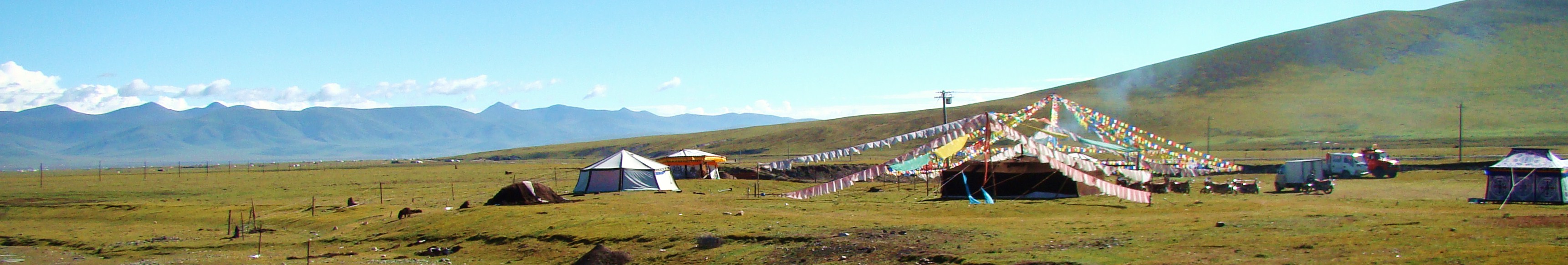
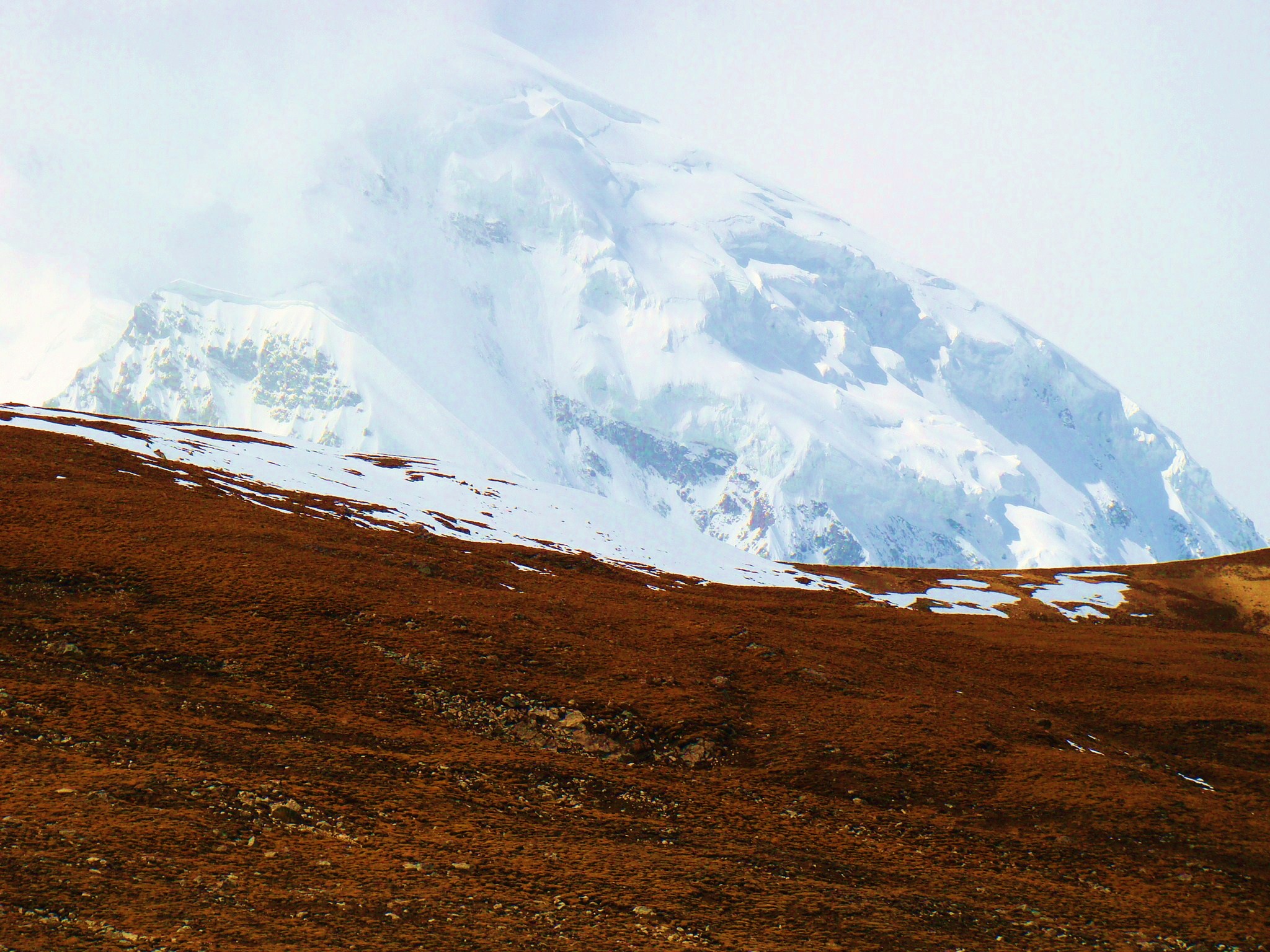
The transcendent beauty of this place is hard to beat. This
is the highest point on the Qinghai-Tibet Plateau, the
pinnacle of the "roof of the world". Further west out of
Shigatse and beyond the Yarlung Tsangbo River
near Gyantse, the land contour is elevated, sloping gradually. Turning
north at No.22 Road Maintenance Station and driving past Dagyatso Lake, you will find your way to the Ngari highlands.
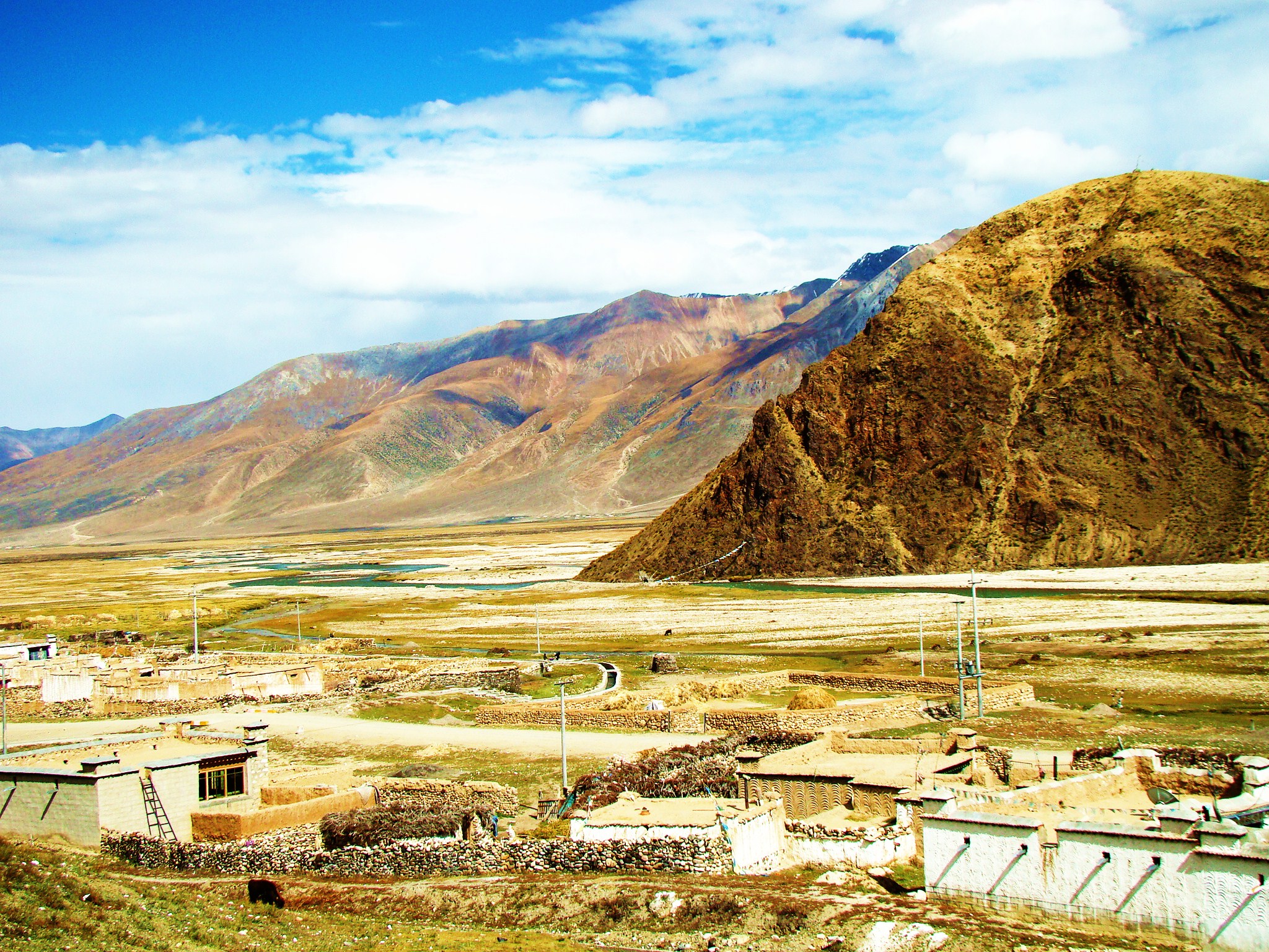
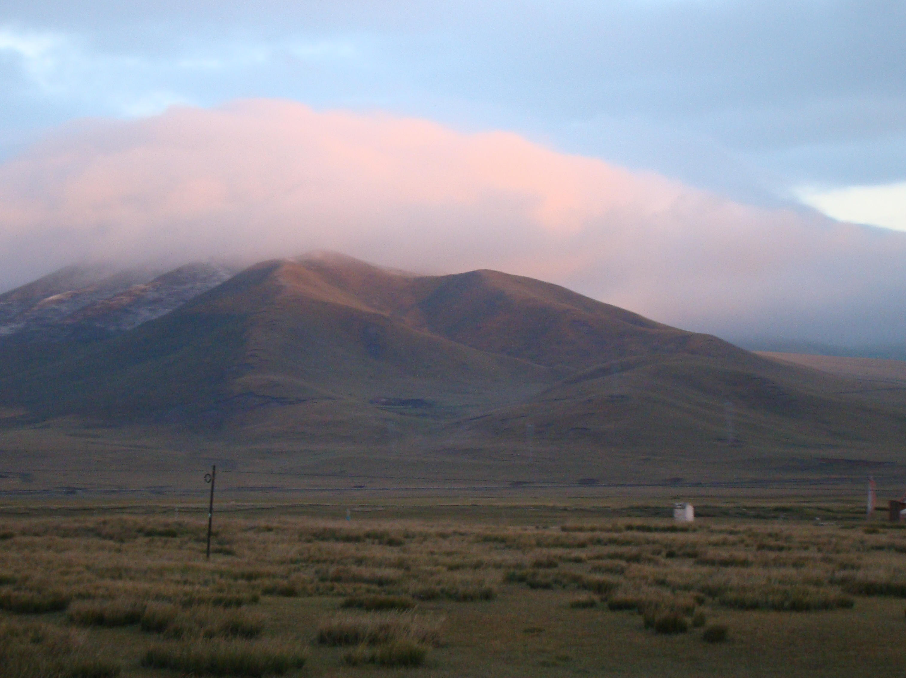
Once there, the expansive stretches of highland pasture,
precipitous, sometimes treacherous, mountains, placid lakes
and foamy swift rivers against a backdrop of azure skies and
floating clouds exhilarate even the tired traveler.
The
majority of the most magnificent scenery actually is found
on the mountain peaks themselves. Of course, not everyone is
cut out for the hardships of this journey. The majesty of
these ranges takes your breath away. The Himalayas, of
course, but also the Gangdise and Kunlun which together span
the Ngari region, covering an unbelievable mass of 340,000
square kilometers (131,274 square miles), around a quarter
of the entire Tibetan land mass. Mountains, sparkling
rivers, gentle inviting streams among the valleys tend to
amaze the gazer. There are four main rivers that wind
through this area and are considered to be the beginning of
the Indus River, the Yarlung Tsangpo River, the Ganges River
and the Sutlej River.
This area is just south of the Xinjiang Autonomous
Region, and just east of Kashmir. The altitude, take a
guess! Yep, 4500 meters or 14,764 feet on average. There are
only about 7000 people living in this area in 2008. Its
seven counties are namely, Gar, Purang, Rutog, Zanda, Gegye,
Gertse and Tsochen. In this place of undisturbed beauty,
the landscape is unique, inspiring, and stunning. WILD WILD
WILD as it is with its 80 rivers and 60 lakes (see why we
can't list all the rivers and lakes in Tibet!), With 19
million hectares (44 million acres! - Holy Cow! - no, no
holy cows, that's India), it is seriously abundant in
mineral and geothermal resources. The flora and fauna here
includes some of the rarest on earth.
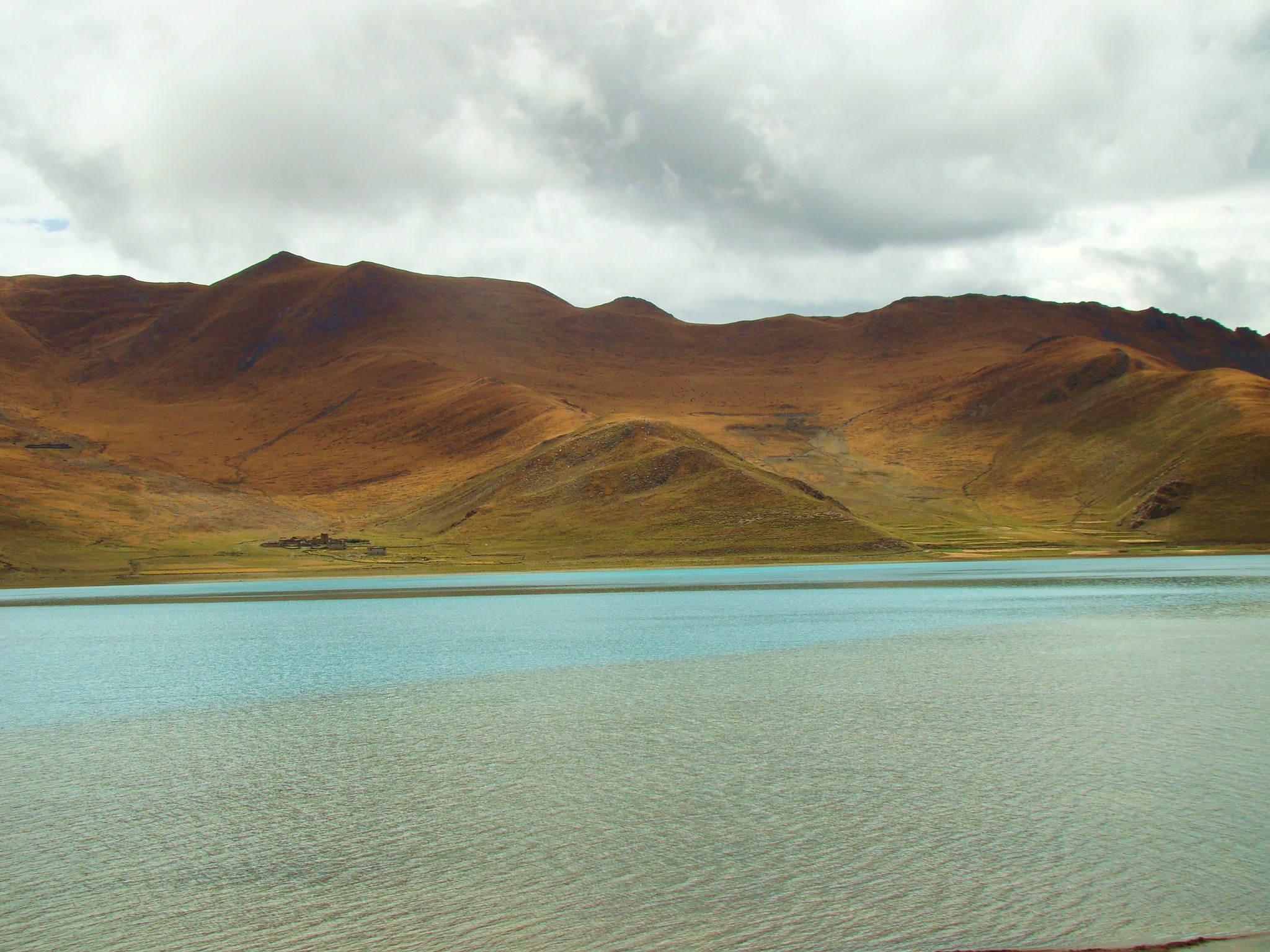
The Bangongtso Lake in northern Ngari has a surface
elevation of 4,241 meters and a depth of 41.3 meters. This
oblong lake extends 150 kilometers and is 50 meters at its
narrowest. The lake water turns salty in the western end. The
lake is ringed by verdant green pastures and has a few small islands
of migratory birds including spotted wild geese,
which often number in tens of thousands in the summer time. The
monastery and cliff drawings found near Rutong and the
uninhabited land in northern Tibet hold special appeal to
explorers.
In this area you will find the mysterious and famous Mt.
Kailash and the Guge Kingdom ruins. This area used to be
almost inaccessible to visitors, but now it can be reached
by several intersecting highways from Lhasa, Nepal and the
Xinjiang Autonomous Region. The main town, Shiquanhe is the
largest city in western Tibet. The road to Shiquanhe begins at
Lhasa,
if coming that way, and passes
through Nakchu.
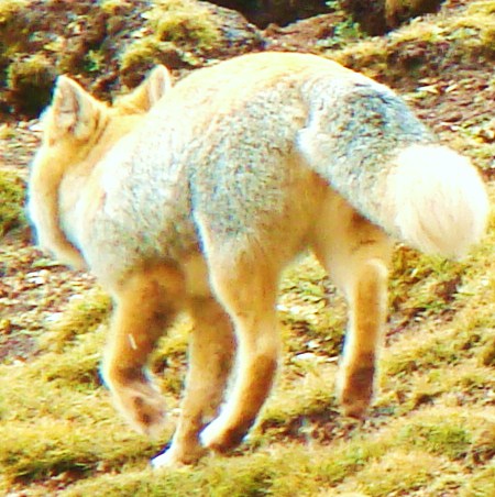 Traveling in the
highland region, one will see changing sights of spectacular
scenery and rich wild life including beavers, rabbits and foxes
not far from roadside. Even wild ducks, black-necked cranes and a
variety of birds are seen by the lake-side. Antelopes, wild donkeys
are found on
hills or in the valleys at dusk time. North of Gertse is the uninhabited zone of
Lugu which is the domain of wild yaks and bears. Yes, this is
WILD Tibet! Traveling in the
highland region, one will see changing sights of spectacular
scenery and rich wild life including beavers, rabbits and foxes
not far from roadside. Even wild ducks, black-necked cranes and a
variety of birds are seen by the lake-side. Antelopes, wild donkeys
are found on
hills or in the valleys at dusk time. North of Gertse is the uninhabited zone of
Lugu which is the domain of wild yaks and bears. Yes, this is
WILD Tibet! |
Awe inspiring "Sacred" Mt. Kailash and "Holy
Lake" Lake Manasarovar are venerated places for many faiths,
including Tibetan Buddhists, Buddhists, Bon, Jains, and to
those with other esoteric beliefs. They come to walk the
kora around the mountain, around the "center of the world".
Not only is this trek a life-long goal for pilgrims, but
many visitors find the attraction irresistible.
Ancient Sanskrit documents tell us the Gangdise Range had become a holy mountain 2,000
years before Christ. A Hindu myth explains how a palace for the
god of gods was build on Mt. Kailash. With 6656 meters, this is
an extremely important mountain in Asian and Tibetan history.
Tibetan Buddhists have a belief that the mountain is in a shape
of an olive. The legendary palace is thought to have been build
right on the peak. Centuries ago a visiting Bangladesh monk
heard bells chiming from the palace, along with drums beating
and mysterious sounds. Even pilgrims today claim to hear things
during their kora around this mount.
Kailash crowns the Himalayan Mountains with its
innumerable myths
and legends. By far, it remains the focus of the religions that
believe in the magnetic draw of the mountain. It takes from
24-36 hours to make the full circle (kora) around the mountain.
Some people caravan with their yaks, camp and do the kora in two
days time.
 This
form of worshipping is common to Tibetan Buddhists who do koras
around all important religious sites. The more koras done, the
better your life now and the next time will be. This deep rooted
notion of circling holy mountains and places started in ancient
times with pagan rituals. This
form of worshipping is common to Tibetan Buddhists who do koras
around all important religious sites. The more koras done, the
better your life now and the next time will be. This deep rooted
notion of circling holy mountains and places started in ancient
times with pagan rituals.
LAKE MANASAROVAR
Lake Manasarovar one of the
highest fresh water lakes of the world, is located over 20 kilometers to
the southeast of Mount Kailash. It has a total surface area of 400
square kilometers. It lies at 4,556 m (14947.5 ft) above mean
sea level. It is one of the highest fresh-water lakes in the
entire world. Lake Manasarovar is somewhat round in shape. The
circumference of Manasarovar is 88 kilometers (55 mi), depth is
90 m (300 ft) and it occupies a total area of 320 square
kilometers (120 sq mi). The lake freezes in winter and melts
only in the spring. It is connected to Lake Rakshastal by the
natural Ganga Chhu channel
 This placid lake is a enormous expanse of
unsullied water. It is absolutely stunning. The legend has it that Goddess Woman bathed in the lake.
Because of its translucent beauty and enchanting myths and legends, the
lake was mentioned as a celestial lake of the west in an ancient
book. The
lake named Macuitso by Tibetans about nine
centuries ago. It was believed that in the "palace of the dragon
king" on the bottom of the lake were boundless treasures. After the rise of Buddhism
in Tibet during the 11th century, the lake was given the Buddhist name
of
"Manasarova", meaning "perpetually invincible".
Since then, the
lake has been regarded as a gift from Buddha with cleansing and
redeeming power that will bring spiritual and physical
well-being. The holy lake seems to possess a primordial force which,
together with the Holy Mountain Kailash attracts infinite
numbers of
pilgrims to the area of Ngari. Even
if it takes years to save money or months to get here, they
still come to test their faith, to gain blessings, to manifest
their discipline and desire for a better life. They bath at four
holy bathing holes situated around the lake to wash clean their
sins and start anew. The mysterious powers of these two holy
places cannot be denied, whether it is the power of the mind or
more, we may only know after we leave this realm and arrive in
the Bardo, the middle place. None the less, those of faith keep
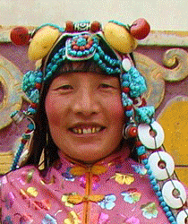
coming, dressed in their native garb with prayers pursed on
their lips. To visitors, there is no where else in Tibet to
match the spirituality of witnessing this mystery of the ages. This placid lake is a enormous expanse of
unsullied water. It is absolutely stunning. The legend has it that Goddess Woman bathed in the lake.
Because of its translucent beauty and enchanting myths and legends, the
lake was mentioned as a celestial lake of the west in an ancient
book. The
lake named Macuitso by Tibetans about nine
centuries ago. It was believed that in the "palace of the dragon
king" on the bottom of the lake were boundless treasures. After the rise of Buddhism
in Tibet during the 11th century, the lake was given the Buddhist name
of
"Manasarova", meaning "perpetually invincible".
Since then, the
lake has been regarded as a gift from Buddha with cleansing and
redeeming power that will bring spiritual and physical
well-being. The holy lake seems to possess a primordial force which,
together with the Holy Mountain Kailash attracts infinite
numbers of
pilgrims to the area of Ngari. Even
if it takes years to save money or months to get here, they
still come to test their faith, to gain blessings, to manifest
their discipline and desire for a better life. They bath at four
holy bathing holes situated around the lake to wash clean their
sins and start anew. The mysterious powers of these two holy
places cannot be denied, whether it is the power of the mind or
more, we may only know after we leave this realm and arrive in
the Bardo, the middle place. None the less, those of faith keep
coming, dressed in their native garb with prayers pursed on
their lips. To visitors, there is no where else in Tibet to
match the spirituality of witnessing this mystery of the ages.
|
The Guge Kingdom
is no more. Left in ruins, it gives us an insight into the
opulent and fantastic life once enjoyed by its rulers.
 The Guge
kings were ardent advocates of Tibetan Buddhism. They sent envoys to India to
invite Buddhist masters to Tibet and sponsored translation
of scriptures. The religious revival began in Ngari and extended
to the entire Tibetan region. The kingdom also kept Tibet
from repeated invasions by enemies from the west.
Mysteriously this place fell to ruin after 700 years of
history. Historians offer a few guesses as to the demise of
this kingdom built on the side of a mountain; war, jealousy,
treachery. According to historical annals, King Tsampo
Lhangdama died and with it the last Tubo kingdom. Two of his
sons, Yundan and Osang were engaged in a bloody war for the
throne which continued for two generations. He also had a
brother, a monk who didn't take too kindly to his
persecution of Buddhism and embracement of Christianity,
knowing it wasn't about religion, but power. It is thought
perhaps his brother sided with others to overthrow the
kingdom that stands on a hill of about 300 meters. A complex
of palaces, temples, fortifications, pagodas and military
tunnels and paths form the ruins of this lost kingdom. The
construction beginning in the 10th century was expanded by
the next 16 successive kings clear up to the 16th century.
Building on these treacherously steep slopes have tunnels
running every which way as secret escape routes, some of
which are filled with severed heads. A brutal battle in the
16th century brought the kingdom to an abrupt end. No
writings can be found today about its fate there after and
the ruins are the only evidence of the once majestic palaces
and crushed glory. The Guge
kings were ardent advocates of Tibetan Buddhism. They sent envoys to India to
invite Buddhist masters to Tibet and sponsored translation
of scriptures. The religious revival began in Ngari and extended
to the entire Tibetan region. The kingdom also kept Tibet
from repeated invasions by enemies from the west.
Mysteriously this place fell to ruin after 700 years of
history. Historians offer a few guesses as to the demise of
this kingdom built on the side of a mountain; war, jealousy,
treachery. According to historical annals, King Tsampo
Lhangdama died and with it the last Tubo kingdom. Two of his
sons, Yundan and Osang were engaged in a bloody war for the
throne which continued for two generations. He also had a
brother, a monk who didn't take too kindly to his
persecution of Buddhism and embracement of Christianity,
knowing it wasn't about religion, but power. It is thought
perhaps his brother sided with others to overthrow the
kingdom that stands on a hill of about 300 meters. A complex
of palaces, temples, fortifications, pagodas and military
tunnels and paths form the ruins of this lost kingdom. The
construction beginning in the 10th century was expanded by
the next 16 successive kings clear up to the 16th century.
Building on these treacherously steep slopes have tunnels
running every which way as secret escape routes, some of
which are filled with severed heads. A brutal battle in the
16th century brought the kingdom to an abrupt end. No
writings can be found today about its fate there after and
the ruins are the only evidence of the once majestic palaces
and crushed glory.
Check out the ruins as you climb the steep slope to the top.
You'll find block house, superb temples, royal palaces and
signs of its past glory everywhere.
 PLEASE
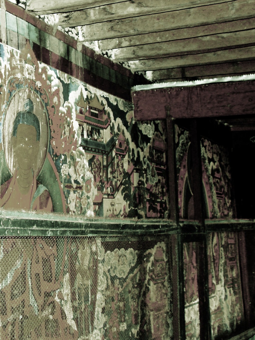
DON'T TAKE ANY CHARDS. The few remains of painted walls,
sculptures and frescoes stand testimony to a unique art
tradition. Even in this dead place, you can feel the living,
see them running about it your minds eyes, hear their voices
echoing off the walls. The view from the top is revealing.
Guge was isolated as it gets. It took twenty years for them
to divert water to the city, now long dry, but you can still
see the riverbeds. How grand this life must have been for
the nobles, while the commoners may have only been
slaves. It's difficult to say. While in Tibet stop in a video
store and by the video "The Lost Kingdom of Guge", well worth
the price! PLEASE
DON'T TAKE ANY CHARDS. The few remains of painted walls,
sculptures and frescoes stand testimony to a unique art
tradition. Even in this dead place, you can feel the living,
see them running about it your minds eyes, hear their voices
echoing off the walls. The view from the top is revealing.
Guge was isolated as it gets. It took twenty years for them
to divert water to the city, now long dry, but you can still
see the riverbeds. How grand this life must have been for
the nobles, while the commoners may have only been
slaves. It's difficult to say. While in Tibet stop in a video
store and by the video "The Lost Kingdom of Guge", well worth
the price!
|